Achievements
Menu
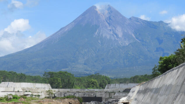
Mount Merapi is one of the most active volcanoes in the world, which is located on the border between Yogyakarta Special Region and Central Java Province of Java in Indonesia. There are important conservation areas at the foot of the volcano such as an urban area with population of about 3 million, the World Heritage sites of Borobudur and Prambanan temple compounds, and the international airport. On the other hand, this area has suffered from disasters such as debris flows at every eruption. Therefore, volcanic disaster prevention project was launched after the eruption in 1969. Based on Japan’s technical cooperation, approximately 250 sabo facilities were constructed in the foothill area with the national budget and Japanese ODA loan.
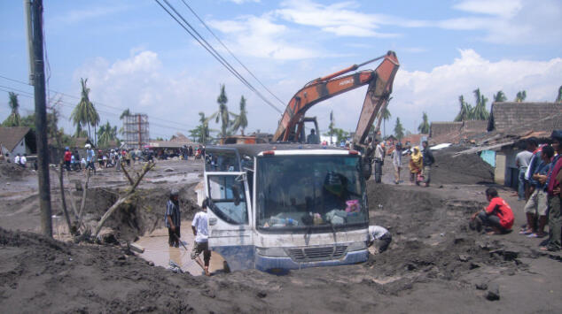
Image of aftermath of Mt. Merapi’s eruption
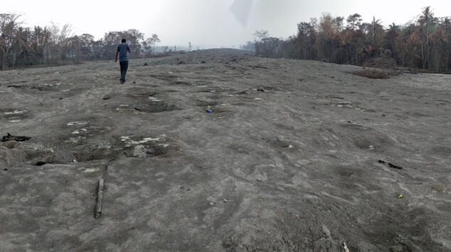
Volcanic ash from Mt. Merapi
Mount Merapi had its largest eruption ever recorded in 2010, releasing a large amount of volcanic debris. Since then, disasters from sediment runoff have become more frequent in areas along the major rivers at the foothills. In the Gendol River, which is located at the southeastern slope of the volcano, pyroclastic and debris flow deposits have completely buried the channel. They have increased flood risk from debris flows. In the Putih River, which is located at the southwestern slope of the volcano, a large amount of volcanic ash accumulated, and the mountain has been eroded at every heavy rain and flowed into debris flows. It has caused more frequent flood and disrupted the neighboring national roads. We reviewed the design and supervised the construction of a sand pocket in the Gendol River and diversion channel in the Putih River. In the first half of the project, we conducted rehabilitation work of existing four sabo dams and 2.2-km long dikes that compose the sand pocket in order to enhance the sediment storage effect. And in the second half of the project, we constructed a new 2.7-km long diversion channel to discharge debris flows downstream without flooding it.
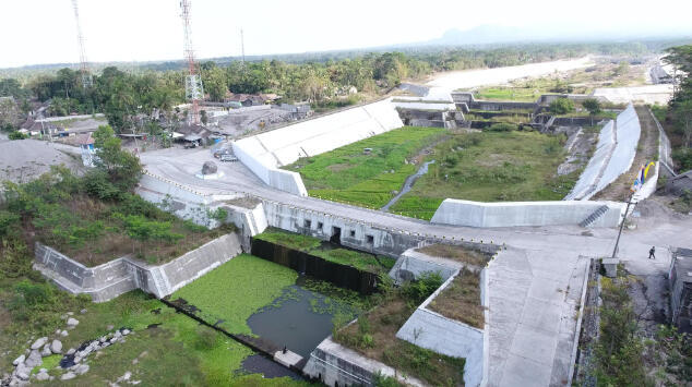
Constructed sabo dam
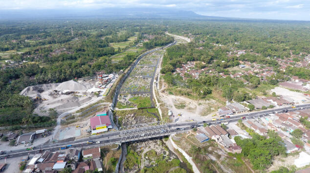
Constructed diversion channel
Originally, sabo facilities function only in the event of debris flows. However, the infrastructure are not fully prepared in Indonesia and it is also required to contribute to local welfare in normal times by adding functions to them. In our project, we added the function of a bridge and irrigation facilities to several sabo dams of the sand pocket and diversion channel in response to the requirements of the local government. They have already been completed, and have become indispensable infrastructure to protect the safety and the lives of the local residents.
Project Details