Achievements
Menu
Nadi Town, which is the third largest city in Fiji, is the center of tourism in the country and has Nadi International Airport. However, the town is vulnerable against flood disaster, such that large-scale flood disasters occurred in January 2009, January and March 2012, and February 2016. Flood damage has become more severe due to climate change. Therefore, alleviating flood damage is a high priority issue for sustainable development in Fiji. The aim of this project is to contribute to the alleviation of flood damage in Nadi River and economic development of of Fiji by comprehensively formulating countermeasures against flood, and selecting and implementing a high-priority project. The following approaches were taken to implement the project:
1) Integrated and adaptive approach including coastal management,
2) Multi-sectoral approach, and
3) Bottom-up approach.
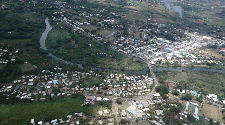
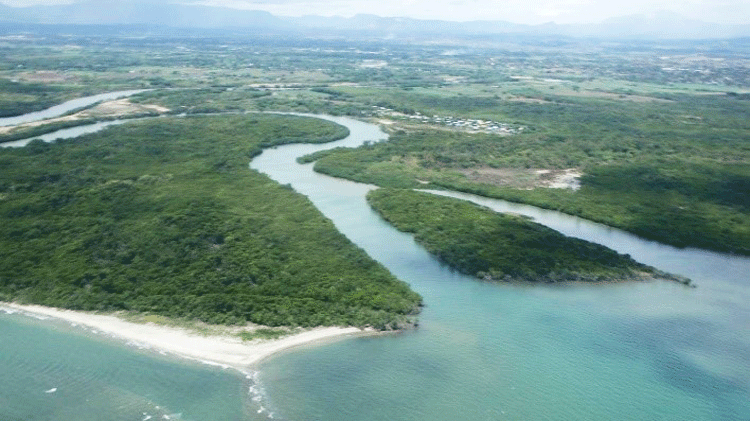
Nadi River and Nadi Town
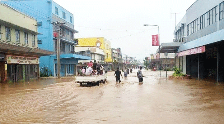
Flood in Nadi Town in 2016
Considering the entire Nadi River region, we planned countermeasures against mitigating the floods with two approaches: 1) measures to reduce the damage from flooding of rivers, and 2) measures to mitigate flood damage from torrential rain that occurs in a short time. We also considered watershed management such as protection and conservation of forests and water resource in the upper reaches, sediment dynamics management, and environmental protection and conservation.
In considering countermeasures against flooding, we designed the entire Nadi River region and sought for the best solutions such as widening the channel of the Nadi River and developing detention basins and floodplains through flood and economic analysis. As countermeasures against inundation of rainwater in the city, we also designed a small detention pond in the city, and proposed renovation and new construction of rainwater drainage channels and maintenance of rainwater storage facilities. In the process, we conducted dialogues with various stakeholders such as the government, business entities, local residents, local
communities, and indigenous people.
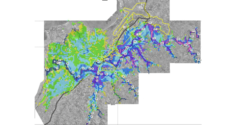
Maximum inundation map (flood simulation result) of the historical maximum flood in 2012. Dark purple indicates an inundation depth of 3 to 5 m, and light blue indicates an inundation depth of 1 to 2 m.
Project Details