Achievements
Menu
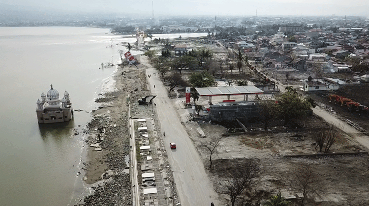
On the 28th of September 2018, a M7.5 earthquake occurred at north of Sulawesi Island in Indonesia. This earthquake caused severe tsunamis on the coastal area, and liquefaction in the inland areas of Palu City, Sigi Prefecture, and Donggala Prefecture. Secondary disaster of landslides followed in the same region, which ultimately became a large-scale disaster with the destruction of 70,000 houses, more than 10,000 seriously injured, and 4,500 dead or missing. Moreover, other social and economic infrastructure such as bridges, seaports, airports, water supply and irrigation facilities, medical facilities, and schools were damaged or destroyed. In response to a request for recovery support from the Indonesian government, the Japanese government launched the project for reconstruction planning and implementation. The project covers a wide scope of works in terms of disaster reconstruction, as follows:
1) Risk assessment and support for preparation of hazard maps covering tsunami, earthquake, liquefaction, flood, and landslide.
2) Integrated supporting for spatial planning and regulations of land use and buildings considering disaster risks.
3) Integrated support for reconstruction planning of multisector infrastructure such as roads, bridges, rivers, sabo, ground improvement, liquefaction countermeasures, irrigation, and public facilities.
4) Pilot project for recovery of the living and communities.
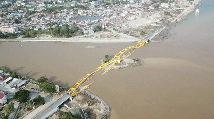
Bridge in the estuary that was destroyed by the earthquake
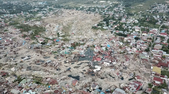
Large-scale damage from a liquefaction landslide like no other in the past
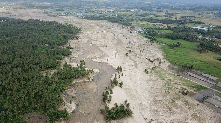
Flooding of the Pal River in the center of the city
Indonesia, an earthquake-prone country like Japan, has recently promoted the consideration of disaster prevention for its development. The purpose of this project is to formulate spatial planning that takes into consideration disaster risks, and promote the reconstruction of the cities. Also, this disaster in this area had some unique features. First, tsunami occurred from the slide of accumulated sand in the sea due to the earthquake, but the epicenter of this earthquake was very close to the land, so the tsunami reached the land quickly with not enough time for evacuation. Second, inland areas had geological features of liquefaction due to the alluvial delta wherein the sand from the mountains have accumulated over the years, so the unprecedented landslide due to liquefaction occurred and brought about severe damage. As Japanese experts, we have provided solutions to these challenging issues in Indonesia, and evaluated the risk of disasters and supported infrastructure development based on knowledge and experience of similar conditions in Japan. For a better reconstruction plan and design of infrastructure, we also supported the Government of Indonesia by providing our expertise such as in reconstruction planning and earthquake-resistant design of infrastructure.
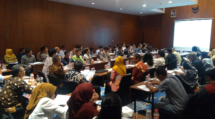
Status of implementation of consultations in Indonesia
Project Details